Sleek International
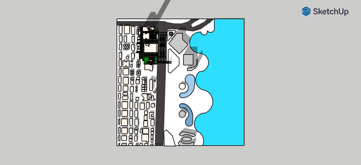


An incredibly lifelike, richly detailed, photorealistic overhead aerial view map of a contemporary urban development nestled along a vibrant coastline. The scene is illuminated by bright, clear daylight, creating a clean and organized atmosphere. Captured with a high-resolution aerial camera, emphasizing sharp edges and subtly textured building facades, the photograph presents a master plan that balances academic rigor with a hint of realism. The left side of the image depicts a densely packed grid of buildings, rendered in muted yellows and whites, signifying commercial zones. These structures vary in size and complexity, with some appearing as simple rectangular blocks and others showcasing more layered architectural designs with hints of darkened green for open interior courtyards or green roofs. A broad, dark grey road runs vertically through this area, acting as a primary artery, with smaller, lighter grey roads branching off, creating a clear hierarchy through varying line weights. Transitioning eastward, the urban fabric softens into recreational and open spaces. These areas are characterized by flowing, organic shapes of light blue, representing residential areas or community spaces, interspersed with areas of muted green, signifying parks and plazas. Distinctive, playful, free-form pools in a lighter, more translucent blue are scattered throughout, adding a touch of leisure and resort-like appeal. The coastline is defined by a crisp white line, meeting a vast expanse of brilliant, saturated turquoise water that dominates the right side of the frame. Crucially, the master plan features meticulously placed dashed section cut lines, labeled A-A’ and B-B’, with directional arrows at each end indicating a precise viewing direction. These lines are strategically aligned with the site's geometry, ensuring clarity for urban-planning professionals. Small, discreet circles (nodes) and stars (landmarks) are thoughtfully placed to highlight key areas of interest within the development, while camera icons mark significant vantage points. Soft, diffused shadows are cast by the buildings, adding depth and volume without overwhelming the clean, academic aesthetic. The overall impression is one of a well-designed, accessible, and aesthetically pleasing coastal community, designed for both functionality and quality of life, presented at a scale of 1:500.